FEMA to discuss Green River flood maps at Sept. 11 Kent meeting

Kent and Auburn residents, business owners and property owners in the Green River Valley can find out about insurance rates and building regulations at a special meeting from 6-8 p.m. Wednesday, Sept. 11 at the Maleng Regional Justice Center, 401 Fourth Ave. N., in Kent.

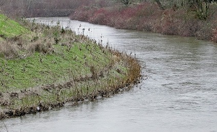
FEMA is working on new flood maps for the Green River Valley.

FEMA is working on new flood maps for the Green River Valley.

Kent and Auburn residents, business owners and property owners in the Green River Valley can find out about insurance rates and building regulations at a special meeting from 6-8 p.m. Wednesday, Sept. 11 at the Maleng Regional Justice Center, 401 Fourth Ave. N., in Kent.

The members of the King County Flood Control District Executive Committee will be joined by representatives of the Federal Emergency Management Agency (FEMA) to discuss FEMA’s flood maps for the Green River Valley.

“This is a great opportunity for the residents, businesses and property owners in the Green River Valley to hear directly from FEMA regarding their plans for future flood maps in the Green River Valley,” said Flood Control District Chair Reagan Dunn, whose district includes a portion of the Green River Valley, in a county media release. “I encourage all who have questions or concerns to attend this important meeting.”

FEMA is responsible for developing the official flood maps defining special-risk areas that may affect insurance rates or building regulations.

“I regularly receive calls and emails from my constituents who want to know what FEMA plans to do with their flood maps,” said Flood District Executive Committee Vice Chair Julia Patterson, who represents communities in the heart of the Green River Valley. “This is an opportunity for the people and the businesses in the Green River Valley to get answers about this important issue directly from FEMA.”

This is the public’s opportunity to meet with FEMA officials and the members of the Flood District Executive Committee to discuss the flood maps and what they mean to residents.

“The new proposed FEMA maps will provide the best available information about potential flooding, which will help to inform residents and businesses on where to likely expect flooding in the future,” said Flood Control District Executive Committee member Kathy Lambert. “We look forward to hearing more about FEMA’s proposal when it is finalized, as it will help our communities protect public safety and make the best infrastructure investments and land use decisions.”

For more information on FEMA Floodmaps, visit: www.fema.gov.


Talk to us

Please share your story tips by emailing editor@kentreporter.com.

To share your opinion for publication, submit a letter through our website https://www.kentreporter.com/submit-letter/. Include your name, address and daytime phone number. (We’ll only publish your name and hometown.) Please keep letters to 300 words or less.
More in News

Courtesy Photo, City of Kent
Kent City Council approves B&O tax increases to hire more police

Additional revenue will pay for four police department positions

t
King County executive will nominate replacements for Upthegrove

District 5, which includes parts of Kent, will get new representative on County Council in January

t
SeaTac man, 21, fatally shot in vehicle in Kent on West Hill

Someone ran up and fired multiple shots into vehicle Nov. 21 at Veterans Drive and Military Road

Kentwood High School, 25800 164th Ave. SE, in Covington, remained without power Thursday morning, Nov. 21, according to Puget Sound Energy. COURTESY PHOTO, Kent School District
Kent schools remain closed due to windstorm damage, power outages

Second consecutive day of closures Thursday, Nov. 21 across the Kent School District

t
Kent-based Puget Sound Fire calls windstorm ‘one for the ages’

Agency responds to 308 calls in 12-hour period, including 245 for storm-related issues

Crews clear trees from State Route 18, which the Washington State Patrol closed in both directions Wednesday, Nov. 20, from Issaquah Hobart to I-90 over Tiger Mountain because of fallen trees during a windstorm. COURTESY PHOTO, Washington State Patrol
Windstorm closes Kent schools, roads due to fallen trees

Many without power in areas of Kent and beyond

t
“Prolific” vehicular theft suspect arrested in Renton

Kent man holds 13 prior convictions and 41 arrests.

tt
Green Kent volunteer program wraps up season at city park

Volunteers remove invasive species, plant native trees and shrubs at Mill Creek Canyon Earthworks Park

t
Copper-wire thieves damage Kent Senior Center roof refrigeration unit

Facility temporarily loses commercial kitchen refrigerator but staff, community keep meals going

t
16-year-old girl dies in Covington single-car crash

Teen was driving when car crashed into a tree Nov. 15 along SE 256th Street just east of Kent

t
Kent Police Blotter: Oct. 24-Nov. 7

Incidents include carjacking, juvenile fight, stolen vehicle pursuit